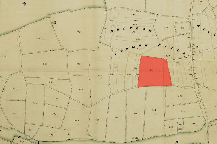
1846 Tithe Map plot number: |
347 |
1896 1:2500 OS Map plot number: |
104 |
aka STIMSONS
Sponge Field was an arable field of about three and a half acres, situated to the west of Port Lane surrounded on three sides by Neltro common field. In the Tithe Award it was measured as 3 acres 2 roods and 4 perches; described on the OS map as 3.941 acres.
In 1792 Sponge Field was owned by James Stevenson.