1846 Tithe Map plot number: |
341-346, 348-352 & 358-366 |
1896 1:2500 OS Map plot number: |
90, 92, 93, 103, 105 & 114 |
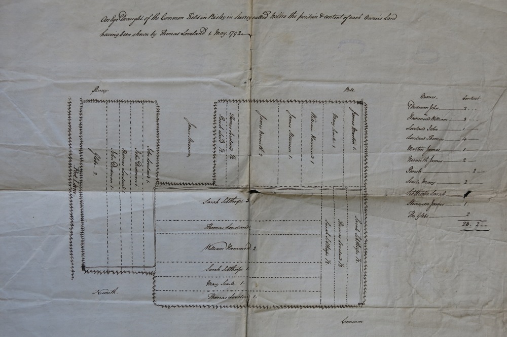
Neltro was one of the seven common fields in Bisley - these were divided into strips and held, copyhold. Neltro was situated in the middle of the parish on the west side of Port Lane and was divided into 20 strips. In the Tithe Award the whole was measured at 20 acres 3 roods and 25 perches.
Alternative spellings include: Neltrowe, Neltroe, Nultrow, Nut Row; The name appears as le Eltrowe in 1345 (i.e. 'the elder tree').

In 1792, Thomas Loveland showed a surveyor around Neltro Common Field, indicating the ownership of the various strips of land.

In 1854, the common fields were enclosed and divided into parcels (as shown below) which were then allotted to various of the copyholders.
