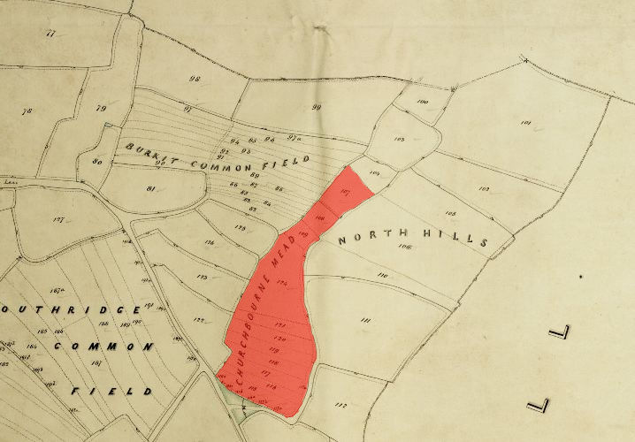
1846 Tithe Map plot number: |
107-109, 115-121 & 124 |
1896 1:2500 OS Map plot number: |
134, 135, 140 & 143 |
Churchbourne Mead was one of the seven common fields in Bisley - these were divided into strips and held, copyhold. Churchbourne Mead was situated in the east of the parish between Burcroft Common Field and North Hills - it was divided into 11 strips. In the Tithe Award the whole was measured at 6 acres and 1 perch.
Alternative spellings include: Churchburn, Church Burn.
In 1854, the common fields were enclosed and divided into parcels (as shown below) which were then allotted to various of the copyholders.
