
1846 Tithe Map plot number: |
30, 75, 213 |
1896 1:2500 OS Map plot number: |
88, 43 or 155 |
The name "Barn Field" has referred to a number of plots of land in Bisley parish.
Plot 30 on the Tithe Map was an arable field of approximately six acres, situated on the north side of Bisley Green adjacent to Bulrowzen Farm. In the Tithe Award it was measured as 5 acres 3 roods and 31 perches, on the OS map as 5.829 acres.
In the mid-eighteenth century Barn Field, along with Bulrowzen Farm, was owned by George Rempnant. When he died in 1774, he left it to his son-in-law John Street. John Street died in 1787 and Bulrowzen passed to his son, Henry; Henry in turn died in 1803 and Bulrowzen passed to his son, James.
James street sold Bulrowzen in 1839, to George Marshall for £450. When George died in 1854, the farm passed to his wife, Sarah who sold the farm, in 1873, to Edward Esdale Clark and Marshall Pontifex.
In 1904, Marshall Pontifex sold his portion of the farm (the farmhouse and lands of just over 21 acres, including Barn Field) to Roderic Bryant Shearburn.
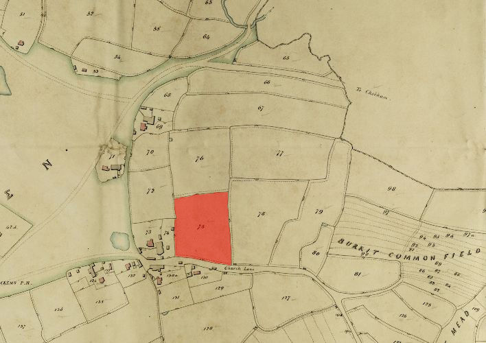
Plot 75 on the Tithe Map was a pasture of approximately three acres, situated on the north side of Church Lane adjacent to Lavendar Farm (later the Bisley Farm School). In the Tithe Award it was measured as 2 acres 2 roods and 3 perches, on the OS map as 3.051 acres.
Plot 213 on the Tithe Map was an arable field of approximately five acres, situated adjacent to the south and west sides of St John the Baptist Churchyard. In the Tithe Award it was measured as 4 acres 3 roods and 1 perch, on the OS map as 4.73 acres.

See also Barn Closes, Part of Barn Field.